Definitive detailed map of Mount Leinster, Blackstairs and the adjacent Barrow Valley. Surveyed extensively on foot and by bike in 2010-2013. Depicts in detail the network of tracks, paths, forests & hills of interest to walkers and anyone interested in the countryside etc. Many historical sites are plotted and named. We have conducted considerable research into local placenames and many names are located & recorded here for the first time on a map. Printed on high quality Enduro 100 gsm paper. Water resistant and tear resistant. 1:25,000 Scale : 1 centimetre on the map = 250 metres on the ground. Contour Interval : 10 metres.
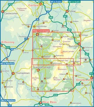
Covers from Bagenalstown to Bunclody and Ballywilliam to The Rower. Published May 2013.


